18th Annual Johns Lake Holiday Boat Parade

18th Annual Johns Lake Holiday Boat Parade

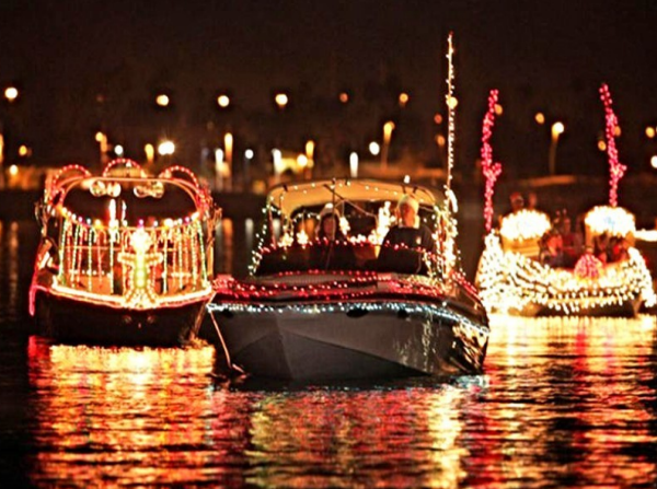
This year is the 18th Annual Johns Lake Boat Parade! The event will be held on Sunday, December 18th at 6:15pm. Come out and decorate your boat with lights and join in the fun! Last year we had 32 boats in the parade, and many spectators at the public boat dock on Lake Blvd.in Winter Garden, as well on the shoreline in many backyards.
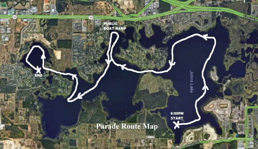
     All boats participating should gather by 6:10 PM in the NW corner of Johns Lake. THIS IS A NEW MEETING LOCATION FROM LAST YEAR. The lead boat will start the parade at 6:15 PM by blasting an air-horn several times. All boats should follow in-line and slowly head east. The parade route will follow the northern, eastern, and southern shores of Johns Lake (from Johns Lake Landing in Lake County to Twinwaters in Orange County, where the parade ends). The parade will take about 2 hours to complete. Please see the Parade Route Map.

If this is your first time decorating your boat for a parade, here are a few tips:

  • Christmas lights run on 120v AC and are designed to operate from your home electrical current. To operate lights on your boat, you will need to purchase a DC to AC power inverter. Power inverters are available at most auto parts stores, Wal-Mart, and Harbor Freight. Power inverters convert your boat’s 12v DC power to 120v AC. Inverters do have a limit as to how much power they can generate from your boat’s DC battery. Inverters are rated by watts; the more watts the inverter can handle, the more lights you can put on your boat. Most power inverters above 150 watts will need to be connected directly to your boat’s battery terminals to provide full power as 12v outlet plugs (cigarette lighters) are power limited by a fuse.
  • The use of LED lights provides the ability to power many more lights than incandescent lights. A 300-watt power inverter connected directly to your battery could power over 600 LED lights as opposed to 60 incandescent lights!  Be careful though, as some units will overheat if too much load is placed on them.  Test your lights for a period of time before the parade starts.  Make sure you use UL-approved outdoor lights as the lights on your boat may get wet and you do not want to cause a fire or shock someone on your boat!

Johns Lake Tussock Issues

Johns Lake Tussock Issues

A.K.A. – The Floating Islands

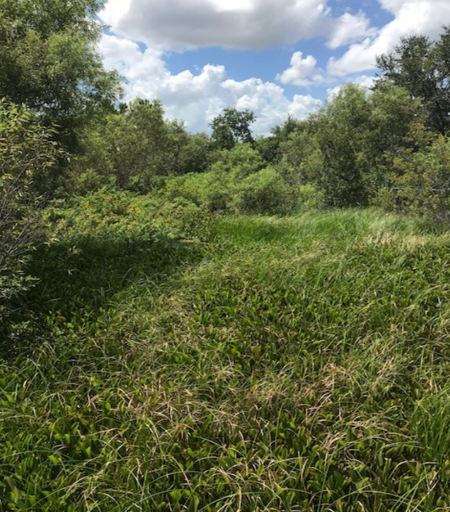
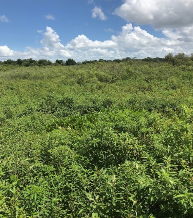
     In April 2017, FWC toured Johns Lake with Habitat and Species personnel to see if associated marshes near the turnpike could be enhanced to increase their fishery value. On May 2, sites in the northeast side of the lake were picked for a vegetation shredding project with funding available in the FWC budget. At the end of May 2018, an FWC habitat biologist out of Eustis (Steve Crawford) contracted a company to open areas that had previously been too dense for fish habitat. The contractor used “barge-like” boats driven by paddle wheels. Attached to the boats were large metal circular “cookie cutter” blades that chopped the vegetation into fine particles that could be quickly broken down by bacteria. That project is now complete.

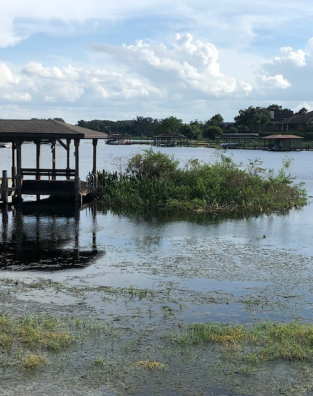
This project activity coupled with the high-water levels and storm winds, created a situation where some of these areas of vegetation (tussocks or floating islands) had broken free and had been floating around the lake. During the week of 10/8, FWC came back out into the lake with the “cookie cutter machine,” air boats and personnel to round up and get rid of many of these nuisance tussocks. 

     Next year, they hope to open areas on the south shore of the lake that have been “choked out” with the exotic torpedo grass. However, the FWC state budget next year is challenged by several projects in the southern part of the state that will take a large portion of their funding to complete. We will update the plans as more detail is available.

Johns Lake Water Level

Johns Lake Water Level

It’s High!

Stormwater Drainage Area, Outflow and Lake Levels

Johns Lake is located in west Orange County and east Lake County. The lake level is dependent on rainfall in an area (basin) comprised of 26 square miles. No streams or springs are known to enter the lake. This basin is located south of Lake Apopka as shown on the following maps outlined in red. The watershed includes fourteen contributing lake systems located primarily to the east of Johns Lake. Surface flow moves generally from east to west through the interconnected lake systems and associated wetlands sloughs. Discharge from Johns Lake is conveyed north to Lake Apopka through a series of cross culverts and open ditch segments. Some of the lakes that flow directly into Johns Lake are, Black Lake, Lake Tilden, and Lake Yarbo. Water levels in these lakes is generally consistent with Johns Lake.

The lake level is not controlled by any agency or group. During periods ofhigh water, the water will flow northward into Lake Apopka. (See the blue line in the current & next map) During the dry season water flow stops for the most part. The water level of Lake Apopka is on average approximately 20 feet lower than Johns Lake. Lake Apopka lake level is controlled via a series of locks and dams by St Johns River Water Management District. While they are interested in the amount of flow from the Johns Lake Drainage Area, they do not monitor it, nor the lake level.

The lake level as of 8/4/2018 was approximately 99.36 NAVD88. ( North American Vertical Datum of 1988 is the vertical control datum, or base measurement point established for surveying elevations .) The FEMA base 100 year flood elevation for the entire basin is determined to be 99.7 NAVD88. See the map below – you can use the URL listed to look at the flood elevation at your location.

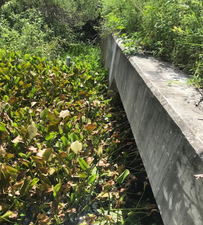
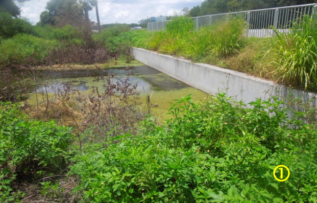
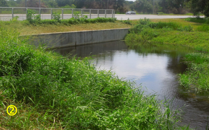
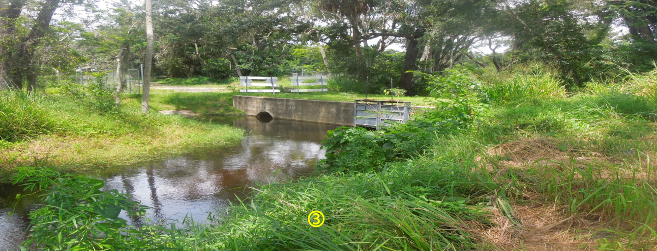
Water is currently flowing about as fast as it can through the various culverts as depicted in the pictures on the following pages. One concern is that very little of the outfall canal/pathway is deeded to preserve integrity of hydraulic flow capacity and maintenance. The City of Oakland has maintained the pathway from Hwy 50 to Lake Apopka, but the pathway from Johns Lake to Hwy 50 crosses two privately owned parcels.

Culvert structure on the south side of Hwy 50, looking west
Culvert structure on the north side of Hwy 50, looking south west. Water is flowing well under Hwy 50, but the culverts are at maximum capacity.
Gate structure just north of Hwy 50. Gates are locked in full open position, and water is not blocked.

Due to recent high water, many docks are either underwater or very close. High water has created danger of submerged docks and posts. Boat wakes cause damage to structures at or nearly under water and cause boards to break free. This is costly for the dock owners and it creates a significant safety concern. Boat wakes are also causing lakeshore erosion in areas where owners have removed all vegetation, and have not planted desirable vegetation. Please be considerate, slow down and use caution as floating boards have already been spotted.

The high water is also causing vegetation to break away and create floating islands that could cause harm to boaters at night. The canal between Johns Lake and Black lake is navigable to the Greenspace Park, recently created off Avalon Road. During Hurricane Irma this canal became blocked to boat traffic with vegetation, so we worked with Orange County to get it cleared. Recently this canal became obstructed again but has been reopened. FWC (Florida Fish and Wildlife Conservation Commission) was out on the lake this weekend to survey the islands and determine the best way to remove them. If we get an update, we will be certain to update you all. 

The high-water situation is unlikely to change anytime soon, and with more rainy months ahead, it will likely worsen. Looking ahead: we are in hurricane season and tropical storms could amplify the problems.

Johns Lake Water Level Fluctuations Illustrated

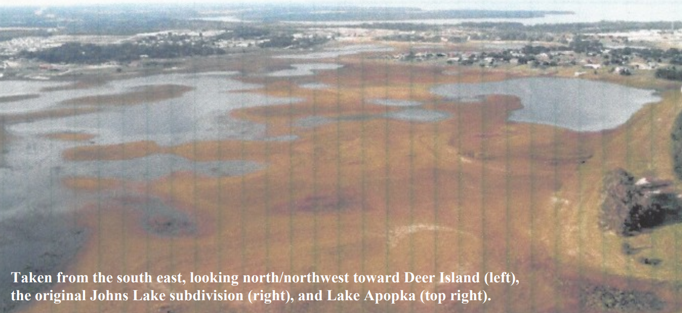
In a previous edition of Cattales, the variability of the water level on Johns Lake was discussed. In that article, we talked about the fact that every approximately 20 to 30 years, extreme drought conditions cause the lake level to drop precipitously and expose large areas of the lake bottom to the drying elements of sun and wind. While this has a temporary but profound dampening effect on the recreational use of the lake, it affords the lake bottom the opportunity to naturally rid itself of accumulated muck and organic materials that may have gradually accumulated over the preceding years. After a period of time the drought conditions lessen, the rains return and the lake levels are restored …but with significantly less muck and organic material on the lake bottom and a much healthier lake. The following two aerial photos were taken in 2001 and illustrate this dramatic phenomenon.

Do You Have Aquatic Midges?

Do You Have Aquatic Midges?

(aka blind mosquitoes)

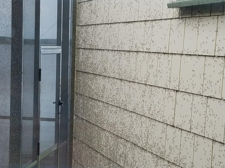
     Aquatic midges, or blind mosquitoes, don’t bite, suck blood, or carry diseases, but they can be a real problem for homeowners on the lake. They can be beneficial as a food source for fish, and lakes where the midge breeds are the best fishing lakes. However, the nuisance created by these little bugs far outweighs the benefit. 

One of our JLIA members shared this photo:

     The aquatic midge has four stages in their life cycle: egg, larvae, pupae and adult. The eggs are laid on the surface of the water in a gelatinous mass that can contain upward of 3,000 eggs that will hatch in 2-7 days. The larvae then feed on that gelatinous mass for about 2 days, they then burrow into the mud and feed off organic matter in the mud and water. After a period of 2-7 weeks, they transform into pupae and swim to the surface of the water. Within hours, the adult midge emerges- then look out!! The adult midges usually emerge in large numbers between April and November. During the day, they hang out in cool shady place and swarm at night to mate, preferring the lighted areas around homes (pools, porches, accent lighting). They do not feed, so they only live 3-5 days, then the life cycle begins again.

     Midges eventually attract spiders, their natural predator. The accumulation of midges in the webs results in frequent washing of home exteriors. As these midges die and decay, they can produce an offensive smell similar to rotting fish.

     Their occurrence and survival often indicates the type and amount of nutrients found in the water. Attempts at control involving insecticides or fogging units only address the adults (who have shown to develop a resistance to pesticides) and can even be counter-productive if it kills the natural predators.  These attempts at control are only temporary as the next generation emerges rapidly. Midges breed in water that is excessively rich in nutrients, frequently caused by runoff from the land that contains organic materials, fertilizers (phosphates), among other materials. These nutrients stimulate the growth of aquatic plant life (such as algae), resulting in the depletion of oxygen. As nutrients increase, so does the population of midges.

Recommendation for lakefront residents:

  • Reduce the use of unnecessary outdoor lighting, and indoor lighting that will attract midges to the
    windows and building
  • Use a “light trap” in a corner of your yard to attract midges. Use of bug zappers is not recommended because they kill beneficial insects as well as the midges.
  • Prevent nutrients from entering the lake by eliminating debris at the lakeshore (leaves, grass clippings, etc.)
  • Prevent fertilizer (phosphate) from washing into the lake by maintaining barriers to prevent runoff
    and by not fertilizing between the barrier and the lake.
  • Consider planting aquatic plants that improve the waterfront by removing excess nutrients that the larvae feed on. Though this is a slow process, it help to improve the overall lake health and wildlife habitat.

All of this information and more can be found on the following University of Florida site.

Johns Lake Vegetation Mapping

Johns Lake Vegetation Mapping

      The vegetation in Johns Lake has been studied to understand native growth and invasive species progression and overall health. The work is conducted by Florida Fish and Wildlife Commission (FWC),
managed out of the Northeast Regional Office, under the direction of Lake County Regional Biologist, Nathalie Visscher (Nathalie.visscher@myfwc.com). FWC used to conduct the study about every
five years, using outside contractors. With recent budget changes, they now conduct a mapping study
every year with internal staff. Since Johns Lake is in Lake and Orange Counties, Lake County takes
the lead.
     In late May of this year, FWC sent teams to complete the mapping for 2017. The data gathering typically takes anywhere from three to five 5 days. They utilize as many as four boats at a time, using
GPS locations, probe poles, depth soundings, and visual observation to collect the information about
the current status of the vegetation growth or decline. They will compile the data into a detailed map
to show the vegetation changes from year to year. The results should be published soon and when it
is available, we will provide a link or copy for your review

17th Annual Johns Lake Holiday Boat Parade

17th Annual Johns Lake Holiday Boat Parade

Sunday, December 17th @ 6:00pm

     This year is the 17th Annual Johns Lake Boat Parade! The event will be held on Sunday, December 17th at 6:00pm. Come out and decorate your boat with lights and join in the fun! Last year we had a record 42 boats in the parade, and many spectators at the public boat dock on Lake Blvd. in Winter Garden, and on the shoreline!

     All boats participating should gather a few minutes before 6:00pm on the southeast corner of Johns Lake. NOTE: THIS IS A NEW MEETING LOCATION. The lead boat will start the parade by blasting an air-horn several times. All boats should follow in-line and slowly head east. The parade route will follow the southern, eastern, and northern shores of Johns Lake (from Twin Waters in Orange County to Magnolia Bay in Lake County, where parade ends). The parade will take about 2 hours to complete. Please see the map below.

     If this is your first time decorating your boat for a parade, here are a few tips: Christmas lights run on 120v AC and are designed to operate from your home electrical current. To operate lights on your boat, you will need to purchase a DC to AC power inverter. Power inverters are available at most auto parts stores, Wal-Mart, and Harbor Freight. Power inverters convert your boat’s 12v DC power to 120v AC. Inverters do have a limit as to how much power they can generate from your boat’s DC battery. Inverters are rated by watts; the more watts the inverter can handle, the more lights you can put on your boat. Most power inverters above 150 watts will need to be connected directly to your boat’s battery terminals to provide full power as 12v outlet plugs (cigarette lighters) are power limited by a fuse.

     Use of LED lights provide the ability to power many more lights than incandescent lights. A 300 watt power inverter connected directly to your battery could power over 600 LED lights as opposed to 60 incandescent lights! Be careful though, as some units will overheat if too much load is placed on them. 

     Test your lights for a period of time before the parade starts. Make sure you use UL approved outdoor lights as the lights on your boat may get wet and you do not want to cause a fire or shock someone on your boat! If you do not live on the lake, you can view the boat parade from the public boat ramp located on Lake Blvd. (north shore of Johns Lake, off of Hwy. 50 at the Lake/Orange County line). The parade should be passing the ramp at approximately 7:00-7:30pm. If you have any questions about the boat parade, please call Ann at 407-701-8033 for details.